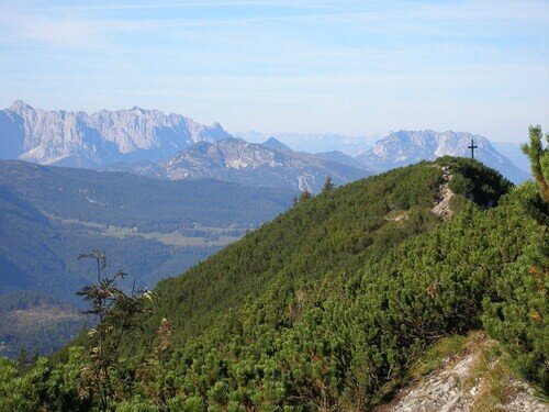
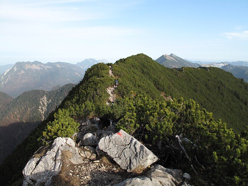
Summit tour via the Wildalm to the Dürnbachhorn. The tour leads back to the starting point via the Winklmoosalm. Use of the nostalgic chairlift possible.
From Heutal in Unken via the Wildalm to the Gimplingsattel and on to the highest point of the tour - the Dürnbachhorn (1776m). This beautiful circular hike leads back to Heutal via the Winklmoosalm. If you use the chairlift (Dürnbachhorn - Winklmoosalm), the walking time is reduced by approx. 1 hour.)From the Heutal car park, cross the Fischbach bridge and turn left up the tarmac road (path no. 16) towards the Winklmoosalm. After about 10 minutes you reach the junction where you take the alpine path (path no. 18) to the Wildalm. Pass the snack station and follow the right-hand track at the fork until the path branches off to the left at a flat section and leads along the lift route to the Gimplingsattel. We follow the ridge up to the Wildalmschneid and along the ridge westwards to the Dürnbachhorn. From the summit, descend to the mountain station of the Dürnbachhorn chairlift (using the chairlift shortens the walking time by one hour), pass to the left into the forest and to the Winklmoosalm. From the valley station we cross the alp in a southerly direction to a crossroads. Here we meet the country lane (trail no. 16), which leads us back to Heutal via Kreuzbrücke.
- Start
- Unken - Heutal
- Goal
- Unken - Heutal
Best Time of Year
Jän
Feb
Mär
Apr
Mai
Jun
Jul
Aug
Sep
Okt
Nov
Dez
Directions & Parking
Parking:
For smooth travel to our tours, we offer comprehensive information and route descriptions. Visit our Arrival & Mobility page for all the details.
Paid car park in Heutal
Public transport: For smooth travel to our tours, we offer comprehensive information and route descriptions. Travelling with the Heutal Shuttle is free of charge with the Salzburger Saalachtal Card. Visit our Arrival & Mobility page for all the details.
Coordinates:
WGS: 47.66155, 12.65085
GMS: 47° 39' 41.6" N, 12° 39' 3.1" E
Paid car park in Heutal
Public transport: For smooth travel to our tours, we offer comprehensive information and route descriptions. Travelling with the Heutal Shuttle is free of charge with the Salzburger Saalachtal Card. Visit our Arrival & Mobility page for all the details.
Coordinates:
WGS: 47.66155, 12.65085
GMS: 47° 39' 41.6" N, 12° 39' 3.1" E
Equipment
Clothing: Comfortable hiking boots, breathable clothing depending on the weather (T-shirt, light trousers).
Equipment: Small rucksack, sunscreen, hat or cap, first aid kit, mobile phone.
Catering: Sufficient water, snacks (energy bars, nuts, dried fruit).
Navigation aids: Map or hiking app, compass (optional).
Other: Light pocket knife or multitool, insect repellent (if required).
As required: rain jacket, sunglasses.
Translated with DeepL.com (free version)