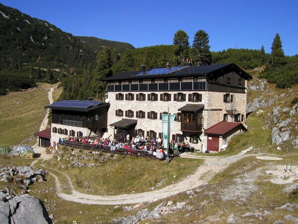
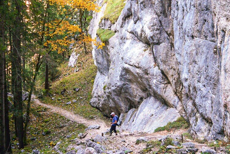
Easy, scenic hike to the Neue Traunsteiner Hütte.
The tour first leads along a marked forest path on the Donnersbach. Via the Alpasteig you reach the idyllically situated Alpaalm and finally continue to the hut. The new Traunsteiner Hütte in the Berchtesgaden Alps invites you to stop for a bite to eat or an overnight stay after the hike. Numerous summit ascents and climbing tours are possible.From Reith bei Unken, walk on the red-marked road (trail no. 470) for a good ¾ h, slightly ascending, along the left side of the Donnersbach stream until you reach a cattle trail (Alpasteig), which leads up to the idyllically situated Alpaalm (1,257 m). Here you ascend on the red-marked trail (no. 470) with steps over terrain interspersed with mountain pines to the edge of the high plateau at 1,650 m. The last part of the hike is on this trail. Finally, follow this trail past the Alte Traunsteiner Hütte (1,579 m) and continue almost flat over alpine meadows to the Neue Traunsteiner Hütte (1,560 m).
- Start
- Reith bei Unken
- Goal
- Neue Traunsteiner Hütte
Best Time of Year
Jän
Feb
Mär
Apr
Mai
Jun
Jul
Aug
Sep
Okt
Nov
Dez
Directions & Parking
Parking:
Coming from Bad Reichenhall in the direction of Schneizlreuth: Follow the B21 in the direction of Innsbruck/Lofer, past Lake Saalachsee and Schneitzlreuth to the state border. On the Austrian side, take the B178 via Unken to Reit.
Car park at the end of Reith (beginning of the forest road)
Public transport: By train from Munich to Bad Reichenhall. From there, continue by bus (line 260) to the "Lofer Reith" stop.
Coordinates:
WGS: 47.62692, 12.72211
GMS: 47° 37' 36.9" N, 12° 43' 19.6" E
Coming from Berchtesgaden via Ramsau: Leave Berchtesgaden in the direction of Ramsau and drive through the village of Engedey. After approx. 6 km, at the Ramsau football pitch on the left, follow the German Alpine Road (B305) straight on via Ramsau-Schwarzbachwacht to Unterjettenberg. From there follow the B21 in the direction of Innsbruck/Lofer, past Schneitzlreuth to the state border. On the Austrian side, take the B178 via Unken to Reit.
Coming from Zell am See, take the B311 to Lofer, direction Salzburg.
Car park at the end of Reith (beginning of the forest road)
Public transport: By train from Munich to Bad Reichenhall. From there, continue by bus (line 260) to the "Lofer Reith" stop.
From Berchtesgaden by train or bus (line 841) to Bad Reichenhall. From there, continue by bus (line 260) to the "Lofer Reith" stop.
Coming from Zell am See by bus (line 260) to "Lofer Reith
Coordinates:
WGS: 47.62692, 12.72211
GMS: 47° 37' 36.9" N, 12° 43' 19.6" E
Equipment
We recommend: Backpack, hiking shoes, hiking clothes, water bottle, sun protection and a snack.